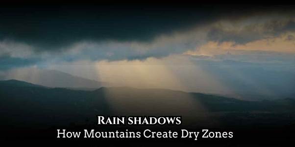
When wind and mountains meet, Rain shadows appear those dry leeward regions where one side of a range is green and the other is arid. This geographic weather pattern explains why deserts, dry valleys, and semi-arid climates often sit just behind high mountain ranges.
Table of Contents
In this article we’ll define Rain shadows, explain the mountain barrier effect and orographic rainfall, give clear examples, and show how communities adapt to and manage the precipitation pattern shaped by topography.
What are Rain Shadows? Leeward Side and Windward Side Explained
Definition and core process
A Rain shadow is a climatic phenomenon in which moisture-laden winds rise on the windward side of a mountain, cool, and release precipitation as orographic rainfall. After losing moisture, the air descends the leeward side as descending dry air, warming and evaporating remaining moisture. This sequence creates a humid windward climate and a dry leeward zone that can become an arid zone or rain shadow desert.
Key elements of the process
• Moisture-laden winds approach the mountain and are forced upward
• Air cooling and rising cause condensation and cloud formation
• Precipitation falls on the windward slopes creating wetter ecosystems
• Descending dry air warms on the leeward side, reducing rainfall and increasing evaporation
How the Mountain Barrier Effect Works: Air Uplift and Cooling
Mechanism of moisture loss and dryness
When air mass movement pushes rain-bearing winds against mountain ranges, the vertical motion triggers cloud formation. Rising air cools, and atmospheric moisture condenses into rain or snow. This air uplift and cooling explains why mountain ranges have lush, green windward slopes while the opposite slopes remain dry.
Why the leeward side becomes dry
• The air loses most moisture on the windward slope through condensation and precipitation
• The now drier air descends, compresses, and warms, preventing cloud formation
• Increased moisture evaporation on the leeward side further limits rainfall
• Over time these conditions form dry region formation and microclimate formation behind the range
Climate and Environmental Impacts: Rainfall Distribution and Microclimates
Importance and regional effects
Rain shadows control rainfall distribution, creating strong regional climate variation across short distances. Plant communities and agriculture on the windward side often thrive, while the leeward side supports drought-tolerant species and different land uses. Some of the world’s most striking examples of rain shadow region examples include the Atacama Desert behind the Andes, the Great Basin east of the Sierra Nevada, and the Tibetan Plateau in the lee of the Himalayas.
Environmental consequences
• Formation of dry deserts and dry valleys that face water scarcity
• Increased risk of a drought-prone area where rainfall is blocked
• Changes in biodiversity and habitat types between slopes
• Localized highland climate effect that influences human settlement and farming
Human Adaptations and Management: Farming, Water, and Planning
How people cope with mountain-induced dryness
Communities in rain shadow zones adapt through irrigation, drought resilient crops, and water storage. Planners use knowledge of topographic influence on weather to site reservoirs and manage groundwater sustainably. In some regions, small-scale cloud seeding and reforestation on windward slopes help stabilize moisture sources.
Practical strategies for sustainability
• Rainwater harvesting and efficient irrigation methods
• Crop choice tailored to semi-arid climate and soil moisture limits
• Land use planning to protect recharge zones and prevent land degradation
Scientific Importance: Studying Rain Shadows for Weather and Climate
Meteorological insights and forecasting
Understanding Rain shadows improves models of air mass movement and helps meteorologists predict mountain slope precipitation. Rain shadow dynamics are critical for regional climate models because they shape water availability, agriculture potential, and wildfire risk.
Research tools and monitoring
• Remote sensing and topographic analysis to map rain shadow deserts
• Field studies measuring humidity, windward rainfall, and leeward evaporation
• Climate simulations that examine how shifts in wind patterns alter rainfall distribution
Challenges and Future Concerns: Drought, Land Use, and Climate Change
Ongoing threats to rain shadow regions
Rain shadow areas can be especially vulnerable to climate change because small shifts in wind patterns or moisture supply change rainfall dramatically. Overuse of groundwater and poor land management can accelerate desertification in rain shadow desert zones.
Priorities for resilience
• Promote sustainable water management and recharge practices
• Restore vegetation on windward slopes to maintain orographic rainfall cycles
• Plan development with the natural constraints of mountain geography in mind
Conclusion
Rain shadows are powerful reminders that geography controls climate. From the humid windward climate that feeds rivers and forests to the dry desert side that struggles for water, mountain ranges set the rules for local weather and ecosystems. Understanding this mountain-induced dryness helps communities adapt farming, manage water, and reduce vulnerability to drought. Learn more about the rain shadow zones near you and consider how topography influences the weather you depend on.